Category filter
Maps and location services – FAQs
General queries
1. What can I do with location services in Hexnode?
Location services in Hexnode can be used to enable location tracking and geofencing. With location tracking, you can –
- View real-time location logs from devices.
- View the history of the locations traversed by the device.
- Export these data as reports.
- Manually send location check-in notes from the device.
- Live-monitor the location of all tracked devices from the dashboard.
- Set up a geofenced area.
- Set up a location-based policy that becomes active inside the geofence.
- Set up location-based compliance checks. Etc.
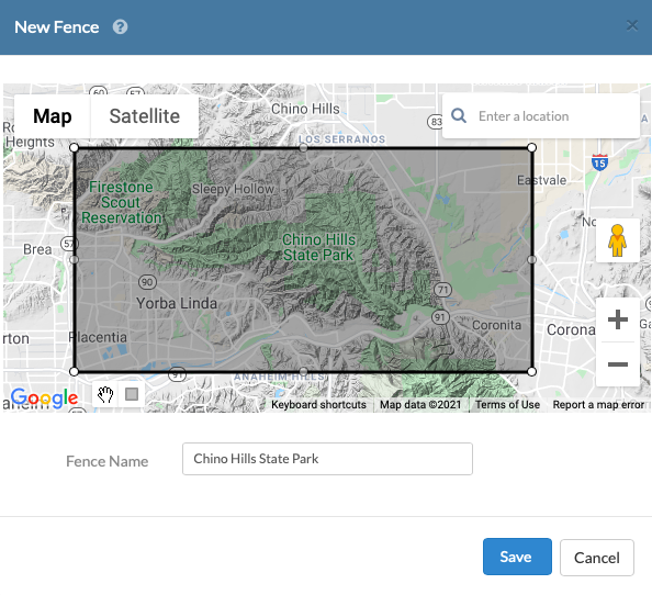
2.What are geofences?
A geofence region can be defined as the virtual parameter set by drawing a rectangle on an interactive map. You may create multiple geofence regions on Hexnode; however, regions can only be marked as rectangular coordinates.
Hexnode allows you to mark a device as location non-compliant when the device moves outside the geofence. You can also create a dynamically grouped devices list based on geofence regions with Hexnode.
Learn more about geofencing with Hexnode UEM.
3. Can I choose a different provider for the map?
By default, your Hexnode UEM come loaded with a map sourced from OpenStreetMap. You may also change the map provider to Google Maps. Read How to Integrate Google Maps API with Hexnode UEM to learn more.
4. Which map should I choose?
OpenStreetMap is a community-driven, open-source project, while Google Maps is maintained and distributed by Google. Our default map is fetched from OpenStreetMap and is free to use. However, to use Google Maps, you need an account with Google Cloud Platform with a valid billing account linked with your project. Google charges you based on the number of API calls made to fetch the map data. Hexnode supports the Maps JavaScript API, which comes under Dynamic Maps. You can learn more about the pricing plan for Google Maps API from the Google Cloud Pricing page.
5. How to change your default map?
You can change your default map from Admin > General Settings >Map Settings.
Note that you need to enable location tracking for devices before using location services on Hexnode.
6. How to enable location tracking for devices?
Location tracking for enrolled devices is disabled by default to protect user privacy. You may enable location tracking for your devices by configuring a policy and enabling Location Tracking from under General Settings for your devices. You may configure the location update interval from once every 15 minutes or in increments of 15 minutes up to 45 minutes or hourly increments from 1 hour to once every 24 hours. Hexnode will automatically initiate a Scan Device Location action based on this and you can view the location updates from the device on the dashboard or the device details page (refer Recent History section under Device Summary or Location History sub-tab).
Ensure the location tracking policy is deployed successfully on your devices from the Action History of associated devices. Once this is done, you may also manually scan for device location anytime by selecting your device and initiating the Scan Device Location action. The device can also send location check-in notes from the Hexnode app on the device by clicking on the location pin icon.
7. How to send location check-in notes from the device?
You can send location check-ins from your enrolled devices to Hexnode. It will contain the latitude and longitude coordinates of the device along with an optional note.
First, make sure you have enabled location tracking for the device. If the feature is enabled, on the device, open the Hexnode MDM or Hexnode for Work app, find the location pin icon in the top right corner, and tap on it. This will prompt a text box where you can attach a note along with the check-in details. Tap Send to confirm.
8. Where are the location notes sent from the device available?
Location notes are notes added while sending location data to Hexnode from the user’s device. These notes will be visible under the Location History report. You may access the report from Reports > Location Reports > Location History.
9. How accurate is the location data sent from the devices?
The location data accuracy is determined by how detailed the latitude and longitude coordinates received from the device are. This depends on the methods used by the device to position itself. The coordinates are obtained using the location services utility on the device and it may use various methods (involving Wi-Fi, IP, cellular network, or GPS) to arrive at the device’s position. Also, the physical location of the device impacts the location accuracy; for example, a device might be indoors where a certain method (say GPS) is not very accurate, or the device might be outdoors where positioning may be more accurate with the same equipment.
So, the accuracy can range anywhere depending on the positioning equipment and the methods. For commercial smartphones, the average location accuracy with GPS reading under the open sky is about 5 m (16 ft).
10. Can you prevent users from using mock locations on Android?
Yes, the use of mock locations can be blocked on Android devices with device policies on Hexnode UEM. With the mock location feature turned on, users can use a third-party application to fake the device location. You’ll find the settings for mock location on Android under Settings > System > Developer options > Debugging.
When a mock location is detected by Hexnode while attempting to scan the device location on Android devices, you might be getting an error warning “Failed to fetch the device location. The location data received is unreliable (possibly a mock location).” on the Action History logs. To prevent users from using mock locations configure a restriction policy and uncheck the option Mock location.
11. Can you group devices based on their locations?
With Hexnode UEM you can create dynamic device groups that automatically group devices based on location conditions. You can do this by linking the device grouping to include devices based on whether it is inside a geofence region(s) or outside. This is also a useful feature to associate policies dynamically based on device location.
Learn more on How to create a dynamic device group?
OpenStreetMaps
1. How frequently is the default map updated?
Hexnode fetches the default map from OpenStreetMaps and maintains the fetched map on Hexnode’s servers. The map is updated every 6 months or so and also when there is a major update on OpenStreetMap.
Google Maps API
1. How frequently is Google Maps updated?
In the case of Google Maps API integration, the map is maintained by Google. Hexnode fetches data directly from the Google Maps server. Every time the map on Hexnode is loaded or re-loaded, and data is fetched newly with the Google Maps API.
2. Does Scan Device Location action involve Google Maps API?
No, the Scan Device Location action from the Hexnode console won’t involve Google Maps API. Manually sending device location from the device also does not involve Google Maps API. Location scans return the latitude and longitude of the device as returned by the GPS equipment. These coordinates are used to derive an address on the map and are marked accordingly when viewed on the map.
3. Will generating location reports involve Google Maps API?
No, generating location reports won’t involve Google Maps API. Location History reports make use of latitude and longitude data fetched from the device along with their address location as fetched previously while loading the map on the dashboard or the device page.
4. Will refreshing the page reload Google Maps?
Yes, refreshing the page will reload Google Maps.
5. Why does my map show “This page can’t load Google Maps correctly”?
If this error shows up on the map window, this means the API key you have provided failed to initiate with Google Maps.
You might want to retry copying and pasting the API key again or regenerating it. The API key should be a Maps JavaScript API and your server URL (e.g., yourportal.hexnodemdm.com) should be allowed as an HTTP referrer. The key is alphanumeric, case-sensitive, and shouldn’t contain any space.
Also, check if the billing account was set up properly for the linked Google Cloud project.
6. Why does my map show a ”For development purposes only” watermark?
When the API key you provided could initiate a valid connection to Google Maps but your billing account is not configured or unaccepted, this watermark will appear over the map. The shaded map that loads won’t incur any additional charge on your Google Cloud console. Fix your billing account from the Google Cloud console to fix this.
